MapWindow 相关
来源:互联网 发布:淘宝上药店 编辑:程序博客网 时间:2024/04/19 19:32
http://www.mapwindow.org/documentation/mapwingis4.8/class_shapefile.html
MapWindow随写(MapWinGIS)
mapwindow 是开源免费的GIS控件
一.准备工作
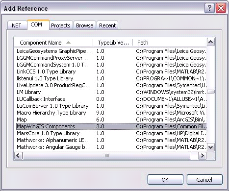
1. 注册com组件http://www.mapwindow.org/ 获取最新控件.
Regsvr32.exe 路径/MapWinGIS.ocx
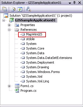
2..新建项目,添加引用
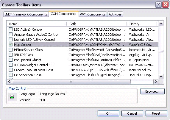
3.添加控件

二.正式编程
1.载入地图
Map Control 控件拖入window form,取名:mainMap。
//图层1返回句柄
Int inthandler1;
//实例化形状文件
MapWinGIS.Shapefile shapefile1 = new MapWinGIS.Shapefile();
//打开文件
shapefile1.Open(@"D:\GISSampleData\base.shp", null );
//载入地图文件,true显示
intHandler1 = mainMap.AddLayer(shapefile1, true);
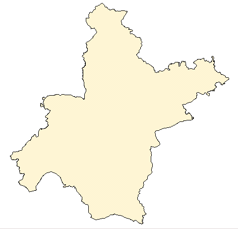 载入成功
载入成功2.缩放功能
mainMap.CursorMode = MapWinGIS.tkCursorMode.xxx;
tkCursorModem 枚举:
• cmZoomIn 放大
• cmZoomOut 缩小
• cmPan 手装选择
• cmSelection 选中
• cmNone 无状态

3 设置点 图层的 颜色 大小 类型
//设置点的颜色,大小,类型 方法(map对象的方法)
mainMap.set_ShapeLayerPointSize(pointHandle, 5);
mainMap.set_ShapeLayerPointColor(pointHandle,(uint)ColorTranslator.ToOle(Color.FromA#ff0000));
mainMap.set_ShapeLayerPointType(pointHandle,tkPointType.ptCircle);
显示出红色的点

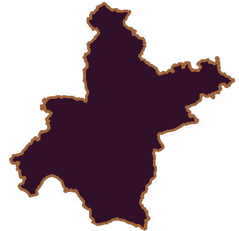
//设置背景填充色,线颜色,线宽 方法(map对象的方法)
mainMap.set_ShapeLayerFillColor(cityHandle, (uint)ColorTranslator.ToOle(Color.FromA#37172c));
mainMap.set_ShapeLayerLineColor(cityHandle, (uint)ColorTranslator.ToOle(Color.FromA#9b643c));
mainMap.set_ShapeLayerLineWidth(cityHandle, 5);
效果图
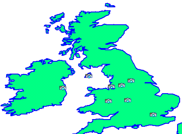
5 给点加上自定义图片
给点加上图片:
//实例化图片类型
MapWinGIS.Image pointImage = new MapWinGIS.Image();
pointImage.Open(@"C:\Documents and Settings\lyp\My Documents\Visual Studio 2008\Projects\MapDemo\MapDemo\ico\hand1.JPG", ImageType.JPEG_FILE, true, null);
//设置使用自定义类型
mainMap.set_ShapeLayerPointType(pointHandle, tkPointType. ptUserDefined);
//设置用户自定义的点图片类型
mainMap.set_UDPointType(pointHandle,pointImage);
参考效果
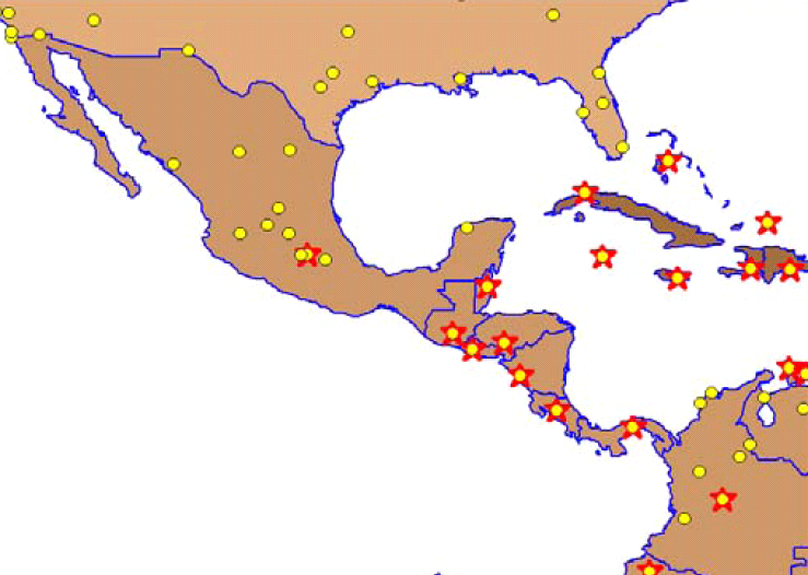
6 给不同类型的点,加上自定义图片
//定义两张不同的图片
MapWinGIS.Image cityImage= new MapWinGIS.Image();
MapWinGIS.Image normalImage= new MapWinGIS.Image();
cityImage.Open(“路径”);
normalImage.Open(“图片路径”);
//获得index
int intCityIndex;
int intNormalIndex
intCityIndex=mainMap.set_UDPointImageListAdd(cityHandle, cityImage);
intNormalIndex= mainMap.set_UDPointImageListAdd(NormalHandle, normalImage);
//在数据库中字段的排号,这儿假设为2
int filedNum = 3
int isCity;
//sf前缀表示shapefile类型
for (int ShapeNum = 0; ShapeNum < sfCitys.NumShapes;ShapeNum++ )
{
isCity= sfCitys.CellValue(filedNum, ShapeNum);
if(isCity==1)
{
mainMap.set_ShapePointImageListID(cityHandle, ShapeNum, intCityIndex);
}
Else
{
mainMap.set_ShapePointImageListID(NormalHandle, ShapeNum, intNormalIndex);
}
};
效果图:
7 显示标签
string labelText = string.Empty;
for (int i = 0; i < pointShape.NumShapes; i++)
{
labelText = pointShape.get_CellValue(filedNum, i).ToString();
x = pointShape.get_Shape(i).get_Point(0).x;
y = pointShape.get_Shape(i).get_Point(0).y;
mainMap.AddLabel(pointHandle, labelText, (uint)ColorTranslator.ToOle(Color.FromA#000000), x, y, tkHJustification.hjCenter);
}
//设置碰撞检测
mainMap.set_UseLabelCollision(pointHandle, true);
参考效果图:
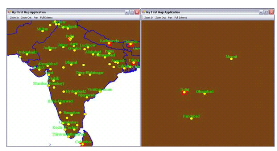
8 LegendControl控件,显示图层
1. 引用MapWinInterfaces.dll文件
2. 控件栏添加该控件
3. 拖入windowform
LegendControl.Legend legend;
legend.Map = (MapWinGIS.Map)mainMap.GetOcx();
//设置图层名称
legend.Map.set_LayerName(cityHandle, System.IO.Path.GetFileNameWithoutExtension(city.Filename));
legend.Map.set_LayerName(pointHandle, System.IO.Path.GetFileNameWithoutExtension(pointShape.Filename));
对于map,相当于代理,里面的方法,属性都相差无几。
效果图

9 map上画线
1. 地图上要激发鼠标事件,必须先设置endMouseXXX 事件
mainMap.SendMouseDown = true;
mainMap.SendMouseMove = true;
mainMap.SendMouseUp = true;
2.画线获取起点
private void mainMap_MouseDownEvent(object sender, AxMapWinGIS._DMapEvents_MouseDownEvent e)
{
mainMap.PixelToProj(e.x, e.y, ref startX, ref startY);
draw = true;
}
PixelToProj ()方法转换 为地图相对应的 点。
(startX,startY) 起点, startX 就是地图的经度,startY就是纬度。于是在移动的时候做了个显示经纬度的。
4. 获取终点
int draw_hndl;
private void mainMap_MouseUpEvent(object sender, AxMapWinGIS._DMapEvents_MouseUpEvent e)
{
mainMap.PixelToProj(e.x, e.y, ref endX, ref endY);
//画图之前,必须有这段代码
draw_hndl = mainMap.NewDrawing(MapWinGIS.tkDrawReferenceList.dlSpatiallyReferencedList);
//画线
mainMap.DrawLine(startX, startY, endX, endY, 1, (uint)ColorTranslator.ToOle(Color.FromA#000000));
}
效果图:

10 获取地图数据
11.经纬度定位
//获取地图区域
MapWinGIS.Extents myExtents = (Extents)mainMap.Extents;
//设置经纬度范围
myExtents.SetBounds(114.38, 30.62, 0, 114.39, 30.632956891957239, 0);
//定位该范围
mainMap.Extents = myExtents;
//设置缩放级别,因为定位的不同,缩放级别肯定不同,比如城市,小区,的缩放级别不同
mainMap.CurrentScale = 0.025;
地名定位:获取数据库中该地名的shape的 ID,然后获取该shape的x y(经纬度),然后在用该方法定位。
三.参考资料
http://www.mapwindow.org
1.UsingMapWinGIS.pdf 初学入门
2. MapWinGIS Reference Manual A function guide for the free MapWindow GIS ActiveX map component.pdf
下载地址
如若转载,请保留作者wallini
- MapWindow 相关
- geoserver+mapwindow
- MapWindow简单入门
- MapWindow简单入门(转)
- 基于VB.NET的mapwindow简单demo源码
- 相关
- 相关
- 相关
- 相关
- 相关
- 相关
- 相关
- 【工作相关】相关博客地址
- stroyboard相关 AppDelegate相关
- https相关、http相关
- hadoop相关 mapreduce 相关
- idea相关 配置文件相关
- JBoss相关
- 验证程序签名
- c语言静态库.h文件的注意事项(一个编程菜鸟记录自己的编程路程)
- 三层架构详解
- eclipse创建webx工程
- 前言——记录Java学习的每一步
- MapWindow 相关
- MySQL中UNION和UNION ALL的使用
- esp
- MQTT推送
- RTP协议分析
- SQLite 增删改查学习教程
- Audio bit rate
- 黑产科普—最近大规模的QQ空间钓鱼攻击
- S5PC100看门狗定时器