【转】Python与ArcGIS Engine的集成
来源:互联网 发布:有没有5g网络 编辑:程序博客网 时间:2024/05/20 10:10
1 在Python中调用AO类库
1.1 准备工作
本文所使用环境:ArcGIS 10.0、Python 2.6。
AO类库在本质是COM组件,在Python中无法直接使用COM,应此需要把COM转换成Python能识别的类型。
Comtypes是一个开源的基于ctypes python的、轻量级的纯COM客户端和服务器框架,利用comtypes可以把AO对象转换成python能识别的类型。Comtypes的下载地址:http://sourceforge.net/projects/comtypes/。
下载完直接安装后就可以在Python中使用了。Comtypes是利用comtypes.client.GetModule方法将需要的类库生成到comtypes/gen文件夹中,因此 首先需要定义一个GetAoModule函数:
def GetAoModule(moduleName):
import comtypes
from comtypes.client import GetModule
GetModule('C:/Program Files/ArcGIS/Engine10.0/com/' + moduleName)
这样就可以引入AO对象库了,比如使用GetAoModule('esriControls.olb'),就可以引入esriControl了。
我们在使用AO时还需要创建AO对象,这里要使用 comtypes.client.CreateObjec来进行创建,在程序中定义一个AoObj函数:
#在Python中创建一个ArcObjects对象
def AoObj(MyClass, MyInterface):
from comtypes.client import CreateObject
try:
obj = CreateObject(MyClass, interface=MyInterface)
return obj
except:
return None
此外还需要定义一个函数用于接口跳转:
#接口跳转
def AoCType(obj, interface):
try:
newobj = obj.QueryInterface(interface)
return newobj
except:
return None
使用AO还需要绑定ArcGIS Engine或Desktop的许可。在ArcGIS 10.0之后,还需要指定ArcGIS的版本。
#利用GP绑定许可
import arcgisscripting
gp = arcgisscripting.create(10.0)
gp.setProduct("ArcEngine")
#初始化许可
GetAoModule('esriSystem.olb')
import comtypes.gen.esriSystem as esriSystem
pInit = AoObj(esriSystem.AoInitialize,esriSystem.IAoInitialize)
eProduct = esriSystem.esriLicenseProductCodeEngine
licenseStatus = pInit.IsProductCodeAvailable(eProduct)
if licenseStatus == esriSystem.esriLicenseAvailable:
pInit.Initialize(eProduct)
这样在python中使用AO的准备工作就完成了
1.2 编写脚本
Python作为一种脚本语言,能够执行批处理程序、开发基于ArcGIS Desktop的小工具,特别是在执行批处理程序上有着很明显的优势。本节利用python编写了一个脚本,用于输出线要素每个结点的M值。
具体代码如下:
#打开Shapefile
GetAoModule('esriGeoDatabase.olb')
import comtypes.gen.esriGeoDatabase as esriGeoDatabase
GetAoModule('esriDataSourcesFile.olb')
import comtypes.gen.esriDataSourcesFile as esriDataSourcesFile
GetAoModule('esriDataSourcesGDB.olb')
import comtypes.gen.esriDataSourcesGDB as esriDataSourcesGDB
GetAoModule('esriGeometry.olb')
import comtypes.gen.esriGeometry as esriGeometry
fileWorkspaceFactory=AoObj(esriDataSourcesFile.ShapefileWorkspaceFactory,esriGeoDatabase.IWorkspaceFactory)
pfw=fileWorkspaceFactory.OpenFromFile('D:/LinearReferencing/',0)
featureWorkspce = AoCType(pfw, esriGeoDatabase.IFeatureWorkspace)
featureClass=AoObj(esriGeoDatabase.FeatureClass,esriGeoDatabase.IFeatureClass)
featureClass=featureWorkspce.OpenFeatureClass("Export_Output.shp")
#选择所有要素
queryFilter2=AoObj(esriGeoDatabase.QueryFilter,esriGeoDatabase.IQueryFilter2)
queryFilter2.WhereClause =''
fs=featureClass.Search(queryFilter2,0)#0就是Fasle
featureCursor=AoCType(fs, esriGeoDatabase.IFeatureCursor)
#创建txt
f=open('D:/M值表.txt','w')
fc = featureCursor.NextFeature()
#循环输出每个线要素的所有结点的M值
while fc:
pFeat = AoCType(fc, esriGeoDatabase.IFeature)
ps=pFeat.Shape
pPl=AoCType(ps, esriGeometry.IPolyline)
pPC=AoCType(pPl, esriGeometry.IPointCollection)
f.write('OBJECTID ' + ','+repr(pFeat.OID)+'\n')
f.write('节点' + "," + ' M值'+'\n')
for i in range(0,pPC.PointCount):
ppct=pPC.Point[i]
pPoint =AoCType(ppct, esriGeometry.IPoint)
ID=i+1
f.write(repr(ID) + ", " + repr(pPoint.M)+'\n')
fc = featureCursor.NextFeature()
#关闭文件输入
f.close()
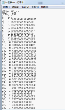
脚本运行完毕后,会创建一个txt文件,里面包含了每条线要素所有结点的M值,如下图所示:
1.3 创建GUI程序
Python是一种脚本语言,但是python也有很多GUI程序包,比如tkinter、wxpython、pyqt等,利用这些程序包可以创建GUI应用程序。本小节利用wxpython调用AE控件创建了一个简单的应用程序,如下图所示。

首先必须引入esriControls.olb,这样才能使用MapControl、TOCControl等AE控件。
#引入esriControls
GetAoModule('esriControls.olb')
import comtypes.gen.esriControls as esriControls
接下来利用wxPython建立框架,并引入MapControl、TOCControl和ToolbarControl。要注意的问题是必须把AE控件当成ActiveX进行转换,这样才能够在Python中应用。
import wx
import wx.aui
#把控件当成ActiveX进行转换
import wx.lib.activex as ActiveX
class MyFrame(wx.Frame):
def __init__(self, *args, **kwargs):
wx.Frame.__init__(self, *args, **kwargs)
self.mgr = wx.aui.AuiManager(self)
#添加AE控件
ax_MapControl = ActiveX.ActiveXCtrl(self,str(esriControls.MapControl ._reg_clsid_),
-1, wx.DefaultPosition,wx.DefaultSize, 0, "MapControl")
ax_TocControl = ActiveX.ActiveXCtrl(self,str(esriControls.TOCControl ._reg_clsid_),
-1, wx.DefaultPosition,wx.Size(200,100), 0, "TocControl")
ax_ToolbarControl = ActiveX.ActiveXCtrl(self, str(esriControls.ToolbarControl._reg_clsid_), -1,
wx.DefaultPosition,wx.DefaultSize, 0, "ToolbarControl")
#把控件添加至Frame中 aui.AuiPaneInfo().
self.mgr.AddPane(ax_ToolbarControl, wx.aui.AuiPaneInfo().Name("地图工具条").Caption("地图工具条").Top())
self.mgr.AddPane(ax_MapControl, wx.aui.AuiPaneInfo().Name("地图控件").Caption("地图控件").Center())
self.mgr.AddPane(ax_TocControl, wx.aui.AuiPaneInfo().Name("TOC目录").Caption("TOC目录").Left())
#设置mapcontrol与 toolbarControl和tocControl的伙伴关系
toolbarControl = ax_ToolbarControl.ctrl
tocControl = ax_TocControl.ctrl
MapControl= ax_MapControl.GetCtrl()
self.Add_toolbar_Command(toolbarControl)
toolbarControl.SetBuddyControl(MapControl)
tocControl.SetBuddyControl(MapControl)
self.mgr.Update()
#向 ToolbarControl 中添加命令按钮
def Add_toolbar_Command(self,toolbarControl):
toolbarControl.AddItem('esriControlCommands.ControlsOpenDocCommand',-1,-1,False,0,1)
toolbarControl.AddItem('esriControlCommands.ControlsMapZoomInTool',-1,-1,False,0,1)
toolbarControl.AddItem('esriControlCommands.ControlsMapZoomOutTool',-1,-1,False,0,1)
toolbarControl.AddItem('esriControlCommands.ControlsMapZoomInFixedCommand',-1,-1,False,0,1)
toolbarControl.AddItem('esriControlCommands.ControlsMapZoomOutFixedCommand',-1,-1,False,0,1)
toolbarControl.AddItem('esriControlCommands.ControlsMapPanTool',-1,-1,False,0,1)
toolbarControl.AddItem('esriControlCommands.ControlsMapFullExtentCommand',-1,-1,False,0,1)
toolbarControl.AddItem('esriControlCommands.ControlsMapZoomToLastExtentBackCommand',-1,-1,False,0,1)
toolbarControl.AddItem('esriControlCommands.ControlsMapZoomToLastExtentForwardCommand',-1,-1,False,0,1)
toolbarControl.AddItem('esriControlCommands.ControlsSelectFeaturesTool',-1,-1,False,0,1)
toolbarControl.AddItem('esriControlCommands.ControlsSelectTool',-1,-1,False,0,1)
class MyApp(wx.App):
def OnInit(self):
frame = MyFrame(None, -1, '在Python中使用ArcGIS Engine',(100,100),(800,600))
frame.Show()
self.SetTopWindow(frame)
return 1
app = MyApp(0)
app.MainLoop()
2 ArcGIS Engine程序中调用python脚本
基于AE的二次开发有很多种方式,包括JAVA、C++、.NET。本节介绍在.NET中调用python脚本。
在.NET程序中使用python脚本,必须使用IronPython。IronPython是一个开源的项目,能够使用户在.NET环境中使用python,我们可以在http://ironpython.codeplex.com/ 上下载对应用python版本的IronPython。最新的IronPython要求.NET版本必须在4.0以上。
下载并安装IronPython后,需要在.NET程序中进行设置。首先在程序中添加IronPython.dll和Microsoft.Scripting.dll的引用,这两个dll位于IronPython的安装目录下。

然后在程序中添加using IronPython.Hosting和using Microsoft.Scripting.Hosting。

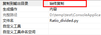
我们还需要把python文件添加至工程中,需要注意的是,要把Python文件的属性“复制到输出目录”设置成“始终复制”。
这样,就可以在程序中调用python脚本了。
ScriptRuntime pyRuntime = Python.CreateRuntime();
dynamic obj = pyRuntime.UseFile("Ratio_divided.py");
obj.Ratio_divided();
需要注意的是Python脚本中不能使用ArcPy包,否则就会出现如下的错误:没有arcpy的模型包。

这样,就可以在程序中调用python脚本了。
ScriptRuntime pyRuntime = Python.CreateRuntime();
dynamic obj = pyRuntime.UseFile("Ratio_divided.py");
obj.Ratio_divided();
需要注意的是Python脚本中不能使用ArcPy包,否则就会出现如下的错误:没有arcpy的模型包。

这主要是因为IronPython不支持ArcPy,因为ArcPy是基于cpython开发的,而IronPython不支持cpython,当然国外也有人用IronClad(一个IronPython)在IronPython中使用cpython的包,但是其对 ArcPy支持不是很好。
详见http://forums.arcgis.com/threads/21405-Arcpy-in-SharpDevelop-4.0
3 Python与ArcGIS Engine集成的几种方式对比
前面介绍了Python与ArcGIS Engine集成的三种方法,现在对这三种方法进行一个比较,见下表。
开发难宜
资源
应用范围
推荐
利用Python调用AO,编写脚本
☆
☆☆☆
☆☆☆
☆☆☆☆
利用Python调用AO,创建GUI程序
☆☆☆
☆
☆
☆
在AE程序中调用Python
☆
☆☆
☆☆☆
☆☆☆
python脚本特别适合一些批处理操作,如果用户要处理空间数据,而又没有ArcGIS Desktop,只有ArcGIS Engine,利用python调用AO写个小脚本,会非常方便,效率也会很不错。当然如果装了Desktop,可以导入ArcPy站点包,那就会更方便了。
利用Python调用AO,创建GUI程序,也是一种可以的方法,但是个人很不推荐,因为comtypes把AO类型库转换后,AO对象的事件很不好操作,当然如果你很爱折腾,又很闲的话,也可以试试这种方法。
而在AE程序中调用Python的话,在某些情况的话也是很不错的选择,比如已经有一个写好的python文件,而里面有个功能正是我们想要的,我们当然要发挥“拿来主义”了。但是我们可以这样想一下,无论是采用.NET还是JAVA或是C++都能很方便的调用AO,那我们为什么还要舍近求远,在Python中使用AO,然后再调用Python呢?
所以个人觉得在ArcGIS中利用python的最好方式就是编写python脚本,这样便能充分python的优势:简洁、高效。
- 【转】Python与ArcGIS Engine的集成
- ArcGIS Engine与ArcObject的区别
- ArcGIS Engine与ArcObject的区别
- ArcObjects与ArcGIS Engine
- ArcGIS Engine与ArcObject的区别与联系
- 关于ArcGIS Engine与ArcGIS Runtime
- 关于ArcGIS Engine与Runtime
- arcgis engine中图层的datasource访问与修改相关
- arcgis engine中图层与数据表之间的join操作
- arcgis engine中图层的datasource访问与修改相关
- arcgis engine空间查询与属性查询的主要代码
- arcgis engine空间查询与属性查询的主要代码
- arcgis engine空间查询与属性查询的主要代码
- ArcGIS Engine中图层路径的访问与修改
- ArcGIS Engine之地图的打开与保存
- ENVI/IDL与ArcGIS Engine一体化开发的实现
- Portal for ArcGIS 与ArcGIS Server的集成方式
- 【转】ArcGIS Engine ITable 与System.DataTable相互转换
- AngularJS框架
- 数据结构之排序4--选择排序
- [容斥] Hihocoder Challenge 32 .B Rikka with String II
- JUnit学习笔记1
- Java使用JNI调用C/C++方法
- 【转】Python与ArcGIS Engine的集成
- 1001. 害死人不偿命的(3n+1)猜想 (15)
- BZOJ3668(Noi2014)[起床困难综合症]--贪心。
- Myeclipse中Action基本配置 There is no Action mapped for namespace [/] and action name [stu] associated 问题
- 操作系统基础
- JAVA初学 面向对象
- C/C++ 64位程序 变量和指针所占内存大小
- 走穿23java种设计模式--12享元模式详解
- sed简单教程