Window Mobile map solutions
来源:互联网 发布:足不出户而知天下三分 编辑:程序博客网 时间:2024/04/30 06:01
From WIKI “Windows Mobile”:http://wiki.openstreetmap.org/wiki/Windows_Mobile
Complete software list
General information
 YesNoYesYesproprietaryfreeEN; ...2012-04-06
2012/04/06Feature rich Amateur Radio Automatic Packet Reporting System client that uses OSM tiles as the base map. Under active development with rapid development release cycle.ArcGIS Editor for OSM [2]
 YesNoNoNoApache License 2.0freeEn2014-03-07
10.2Allows users to download, edit, and upload OSM data in ArcMap, and/or create feature services based on OSM data in ArcGIS ServerArcGIS Editor for OSM [3]
YesNoNoNoMSPL?2.1Надає можливість отримувати, редагувати та надсилати OSM-дані використовуючи ArcMap, та/або створювати сервіси об'єктів на базі OSM-даних використовуючи ArcGIS ServerAutosputnik 5 [4]
 YesYesNoYesproprietary15€EN; RU; UA; BY; KZ; UZ2011-03-10
1.0.31970Easy and nice UI, web-like search, routing, navigation. OSM support:http://openstreetmaps.rube-on-road [5]
 YesYes?
3.9.26385Offline multi-language voice navigation app with lane-guidance assistant. Data from OSM and propietary maps.BetterSoftwareGPSPDA
 YesNoNoYesproprietaryfreeEN2008-08-08
3.5.0.2 Bluemapia [6]
 YesNoNoNoproprietaryfreeEN2009-06-01
0.9.6Marine mapping app for bluemappia.comBT747 [7]
 NoNoYesYesGPLfreeDE; EN2010-08-13
2.x.1769MTK GPS chip sets only!cachebox [8]
 YesYesNoNoGPLfreeEN2010-08-22
500Geocaching centeredEndomondo [9]
 YesNoNoNoProprietaryfree?
 YesYesYesNoproprietary50€DE2012-03-08
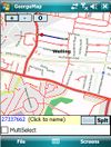
2.0Fast rendering, no install; easy to useGeorgeMap [11]
 YesNoYesYesBSDfreeEN2008-02-12
?
 YesYesYesYesproperitary?
2.03.4 Gobiz Mobile [13]
 YesNoYesYesproprietary?
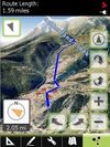 YesYesYesYesproprietary$6.99 / freeEN2012-05-31
1.0.10Google Earth like 3D Navi with DEMGPS-Mate [15]
 YesYesYesYesproperitary23€DE; EN2010-05-31
2.2.2 GPS-Tracks [16]
 YesYesYesYesproprietaryfreeEN; DE; FR; IT2012-01-26
1.61 (iPhone); 1.52 (Windows Mobile); 1.30 (Android) GPS2Blue [17]
 ?
?2.0Tunnels GPS stream via virtual ComportGpsCycleComputer[18]
 YesNoYesYesbsdfreeEN2012-05-27
4.9simple trackingGPSdash [19]
 YesYesYesYes$?
2.5.0 GPSed Mobile Application [20]
 YesNoYesNoproprietaryfreeEN?
3.7
 NoNoYesNoGPLfreeEN2010-06-30
0.5 gpsVP [22]
 YesYesYesYesBSDfree142012-02-05
0.4.24 gvSIG Mobile Pilot[23]
 YesNoYesNoGPL;freeDE; EN2010-08-02
0.3Pocket GISKDR GPS Tracker[24]
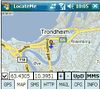
2.68 Rev.3feature-rich Logger (alarms,track convert+management,...)LocateMe [25]
 YesNoYesNoproprietaryfreeEN2009-12-27
?
 YesYesYesYesproprietaryfreeCZ; DE; EN; RU; ...2013-05-20
12.1.10Profesjonalne oprogramowanie dla nawigacji samochodowej opartej na OSM.mapFactor Navigator free [27]
YesYesYesYesproprietaryfreeCZ; DE; EN; RU; ...2013-05-2012.1.10professional framework for OSM-based car navigationMemphis [28] ?
0.2.3map rendering application and libraryMoNa [29]
 YesYesNoYesGPLfreeDE2010-07-13
1.0.6MoNa ist eine unter JavaME entwickelte Ortungs- und Navigationslösung, welche sich die freien Daten des OpenStreetMap-Projektes zu nutzen macht.MoNav [30]
 YesYesYesNoGPLfreeEN2011-04-23
0.3Contraction Hierarchies routing,
custom speed profiles,
extremely fast and resource conservative routing,
can handle huge graphs like Europe on mobile devices. Only source code available for download - has to be compiled by yourself!MOSME
 ?
??
 YesNoYesNoproprietaryfree72010-11-24
0.95 Navio [32]
 YesYesYesYes25$?
3.15
 YesYesYesYesGPLfreeEN2011-07-05
0.2.6 Navitel [34]
 YesYesYesNoproprietary17€EN; RU2011-06-10
5.0.0.1620Popular in RussiaNoni GPSPlot for Windows Mobile[35]
 YesNoYesYesproprietaryfreeEN2010-08-22
3.0.2 Open Car InfoTainmenT system[36]
 YesNoYesNoGPLfreeEN2008-06-12
0.1.0-rc1Navi as part of an car infotainment systemOpenCityMap [37]
 YesNoYesNoGPLfreeEN2008-06-01
0.1.1 Osmeditor (QT)
 ?
??
alphaVery early stage!OSMtracker
0.10.1 outdoor-gps [39]
 NoYesYesYes$?
1.3 R276 OziExplorer [40]
 YesYesYesYesproprietary30€EN2010-05-05
3.95.5kFeaturerichPathAway GPS [41]
 YesYesYesYesproprietary60-95$EN; DE2009-10-01
5.0Deals with a lot of geo datumsPocketGIS [42]
 YesYesYesYesproprietary0RU;2011-04-16
0.95/0.60 "Сейда"Easy and nice UI, web-like search, routing, navigation.PTGMAP [43]
 YesYesYesYesproprietaryfreeEN2010-11-16
1.2.9 RoadMap [44]
 YesYesYesNoGPLfreeEN2009-02-02
1.2.1 RoadMap Editor[45]
 YesYesYesNoGPLfreeEN; HE?Fork of RoadMapRun.GPS [46] YesNoYesYesproprietary20€DE; EN; ...2010-07-07
2.37Sport focused loggerTurbo GPS [47]
 YesYesYesYesproprietaryfreeDE; EN; ...2012-09-07
2.73TurboGPS is a fast all in one GPS tool. Moving maps custom or online, tracks, way points.VataviaMap [48] YesNoNoNoArtistic License;GPLfreeEN2011-22-03
0.0.0.3Display for several map sources like OSM, Yahoo and others ... Desktop version requires .NET-Framework 2.0 or newer, tested with MONO-framework under Linux and MacOSVisualGPSce [49]
 YesNoNoNoproprietaryfreeEN?GPS signal analysesYourPocketMap[50]
 YesNoNoYesproprietaryfreeEN2010-11-11
0.1.3
This table is generated automatically by a bot. Do not edit it manually. Learn more.
Map display features
This table is generated automatically by a bot. Do not edit it manually. Learn more.
This table is generated automatically by a bot. Do not edit it manually. Learn more.
Track making features
This table is generated automatically by a bot. Do not edit it manually. Learn more.
Monitoring features
This table is generated automatically by a bot. Do not edit it manually. Learn more.
OpenStreetMap editing features
This table is generated automatically by a bot. Do not edit it manually. Learn more.
Data Logging
A number of programs are available for collecting GPS tracks:
Free Software/Open Source
- gpsVP (http://gpsvp.com/ ) Garmin and raster (including OSM: Mapnik preconfigured, other raster maps can be configured) maps support, Windows smartphone, PDA and desktop support, track logs. (BSD license)
- NaviPOWM Displays current position on a OSM based map. Records track data in NMEA format. (GPL)
- Bluemapia Mobile (sourceforge) Windows Mobile (PDA and smartphone) free and open source client for bluemapia.com. GPS Chart Navigator for outdoor activities supporting several maps including OSM. Records track data in NMEA and GPX format. (GPL)
- OSMtracker (GPLv3, PocketPC and SmartPhone)
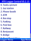
- BT747 (GPLv3) to talk to MTK loggers - possibility to log special waypoints on 'Mobile Platforms' like the PDA and the Java Phone.
- GeorgeMap (BSD) Displays OSM tiles, with nodes / ways overlaid. Currently can edit way name tag / split ways and upload back to server. GPS Support.
- RoadMap (http://roadmap.sourceforge.net/). Development has started again and merged some of the features from RoadMap Editor. Support for OSM is ongoing, no route planning yet (GPL >=v2 license). Not yet available as a download for window mobile.
- RoadMap Editor (http://www.freemap.co.il/roadmap/) - based on Roadmap sources, still in development by Ehud Shabtai, available for Linux/GTK2, Windows mobile, Windows XP and Java ME devices, localization possible through plain-text language file, route planning, built in map editor. (GPL >=v2 license). It is not yet available as a download for Window Mobile.
- Gosmore - will log a GPX trace, and allow you to add OSM features, as well as displaying the map, and performing routing.
- Gpsmid can be run on Windows Mobile / CE devices, see http://wiki.openstreetmap.org/wiki/Software/Mobilephones#JavaME_Midlets_on_Windows_Mobile
- Navit cross-platform Windows/Linux/iphone/WinMobile application with offline (!) routing http://wiki.navit-project.org/index.php/Navit_on_WinCE/Windows_Mobile
Noncommercial
- Mobile OSM Editor to be announced.
Freeware
- GPS Sport Tracker GPX log and OSM rendering
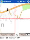
- BSGPSPDA (out now and contributing to the map)
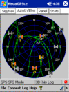
- VisualGPSce (visualgps.net) from VisualGPS llc. It saves data as NMEA logs.
- Noni GPSPlot Moving-Map, GPX export. Map download tool for OpenStreetMap available.
- TurboGPS Fast all-in-one GPS tool. Moving maps custom or online, tracks, waypoint, there is a PC and Windows Mobile Version. Map Download tool for OpenStreetMap available.
- PTGMAP Moving / rotating map / tracklog, and GPS navigation. By using Mkgmap you can create an .img file and load it to PTGMAP. You can define hardware buttons to create a waypoint at the current position. This is really helpful for OSM tracking.
- Cachebox - for Windows Mobile 5 Professional (PDA). Geocaching software that uses OSM tiles for displaying the map.
- OfflineCacher - for Windows Mobile Standard (Smartphone). Geocaching software that uses OSM tiles for displaying the map.
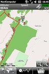
- NaviComputer for Windows Mobile with ver. 6.1 or above, requires .NET Compact Framework 3.5, tile download for each zoom level from many sources like OSM or others, also for offline-use when no Internet connection is available, save tracklogs in GPX format. The app has been blocked for Tile Abuse (though maybe not the latest version Anyone know?)
- Mobbyway for Windows Mobile with ver. 6.1 or above, needs .NET Compact Framework 3.5. French solution to upload tracklogs in GPX format and more.
- OpenMobileMaps Description needed, needs .NET Compact Framework 3.5
Commercial
- Gobiz Mobile ([51]) Display and save OpenStreetMap for offline use! Georeference your photos, videos, audio, POIs, tracks; view your tracks in Google Earth in 3D with 3D data types; runs on Windwos Mobile 5.x, 6.x (~upon request ???)
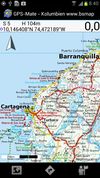
- GPS-Mate (gps-mate.com) Displays the OpenStreetMap and other - even georeference your own - topographic maps; record, manage, plan and export GPS tracks (various formats); available for Windows Mobile PDA + Windows CE PNA's + Windows PC; English/German (~23 ???)
- Glopus (glopus.de) 3D map, track log, etc., only German (Shareware, 20 ???)
- GPS Data Logger 2005 (geoaps.com) (commercial, $ 70)
- GPSGate (franson.com) will record a GPS log, and will also allow you to share one GPS between several GPS applications running at the same time. (Commercial, US$ 30)
- BeeLine GPS (visualgps.net/BeeLineGPS) Also has a log recording function. (Shareware, US $ 30.)
- GPSDash (wimobi.com/gpsdash) (Shareware, 23 ??? ~ 27.6 $.)
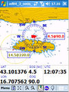
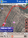
- Navio (tinystocks.com/gps) (Shareware, 23 ??? ~ 24.9 $) I have found it quite practical and reliable for OSM tracking (on an iPaq 6915). Logs are in NMEA format. You have to buy a licence to make logs. Waymarking facilities are poor. Can display position on a downloaded PDF or JPEG map image, but I haven't tested that.
- CartoType (cartotype.com) - Available now for Windows, Windows Mobile, Symbian OS, and Palm OS 5. CartoType is owned and developed by Graham Asher of Cartography Ltd
- Run.GPS (rungps.net) (Shareware, 25.95 ??? ~ 33.99 $) is software for Windows Mobile Pocket PCs and smartphones that can synchronise multiple tracks directly to OSM through Wi-Fi, GPRS or UMTS
- GPS Tuner (gpstuner.com) ($34 - With one-year free upgrade). Can directly download OSM maps or use the free map calibrator.
- MioMap/IGO My way (mio-tech.be) Quite expensive, depending on the maps you buy. But if you already have this software, it can record tracks and export them as GPX.
- OziExplorerCE ($ 95 / ??? 69 for life-time license). Runs on various handheld devices starting with Windows CE 3 through Windows Mobile 6+ and CE.net. An unregistered version will require manual GPS communication restart every 20 or 10 minutes. Can be used with any raster map - scanned or converted. Track logs and POIs are compatible with GPSBabel. The GPS recordings will be in NMEA format. If you need the recorded track as aGPX file (for example when you want to upload the recorded tracks directly to the OSM-server) have a look at converting NMEA to GPX.
- Further details can be found on Making_Tracks_with_Homebrew-ware#Windows_Mobile.
- PathAway ([52]) (Commercial, Standard $60) - For Windows Mobile, Symbian, and PalmOS. Can directly download OSM maps ($95 Professional version only), or use your own raster maps using the calibration tool. Can record tracks and export them as GPX.
- odgps (outdoor-gps.de) GPX track logging, waypoint navigation and statistics. There is also a German manual.
- I have quite good experience with this program. Only after 60 to 90 min., the memory fills up, so I save, restart and go on. Works.
- Well with 240x240 screen resolution. --Georg 07:09, 28 April 2007 (BST)
- Moved here from Freeware, because it has become shareware ... but with a reasonable price --Chaosben 13:05, 10 September 2010 (BST)
Using OSM data
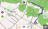
BSGPSPDA Freeware - tracks your position on downloaded Osmarender tiles (zoom 10 to 17). See instantly missing ways, POI's, etc. Records tracks in GPX and voice recorded waypoint and PIO descriptions.
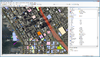
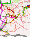
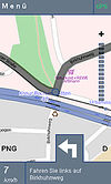
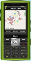
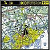
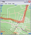
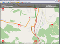
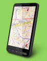
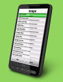
PocketMV is a shareware program which will display Garmin img files on a Windows Mobile device, and then if you have a GPS connected will display your position on the map. It features a search facility allowing you to search for roads and points of interest. Suitable img files can be created using Mkgmap. The following image shows a screen shot from an HP Ipaq in the area of Ryde, Isle of Wight:
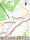
OZIexplorerCE, see Oziexplorer for details:
gpsVP is an open-source (BSD license) that supports using Garmin .img map format files and shows online OSM maps (Mapnik is preconfigured, it is possible to add a configuration file for other online raster maps like Osmarender) on Windows Mobile devices (smartphone or PDA) and also on Windows Desktop computers. By using Mkgmap you can create an .img file and load it to gpsVP.
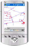
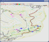
Gosmore is a routing application that uses OSM data:

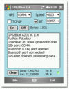
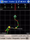
Run.GPS is a shareware program that can display OSM data and load map tiles on demand through a cell phone Internet connection (GPRS, UMTS):
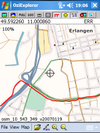
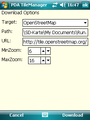
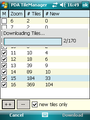
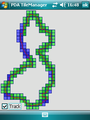
PDA TileManager is software that can download OSM tiles along a GPX track. For Windows Mobile with installed .NET CF 2.0 or above. It works perfectly together with Run.GPS:
Map Calibrator creates OSM maps. I use them in the GPS Tuner and in the Turbo GPS on my WinPDA:
locr GPS Photo for Windows Mobile Version 2 Alpha 1 is a free client application for Windows Mobile 5 and Windows Mobile 6 PDAs to geotag photos which uses OSM maps for orientation purposes.
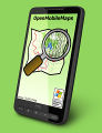
OpenMobileMaps is a moving map application similar to Google Maps, but it is using OSM data instead. If a data connection is available, it automatically downloads tiles and allows to search for places. In offline mode it shows cached map-tiles. If a GPS device is available, the current position can be shown on the map and the map automatically moved.
Audio Logging
- OSMtracker direct audio recording in the application
- BSGPSPDA (freeware, out now and contributing to the map)
- BT747 can be used to do audio or voice tagging by using your phone, PDA or other digital recording system and match the dated files against your track log (MTK logger, or NMEA, GPX, CSV).
- See PDA Voice Recording for information on using your Windows Mobile device to record audio whilst you are mapping.
Port splitting
If you want to run more than one application that need access to your GPS you might need a port splitter software.
- GPS Intermediate Driver Built-in solution for Windows Mobile 5 and up.
- GPSGate Share one GPS port between several GPS applications running at the same time.
- Port Splitter Freeware software useful to split COM port on a PDA.
- HandyGeocaching Porter CZ - HandyGeocaching Porter, freeware, but it is beta
JavaME Midlets on Windows Mobile
(Including Windows CE)
In the table above we have many Java-Midlets that can handle OSM data. These midlets are running not in Java, but in Java Micro Edition (Java ME).
The phoneME project is Sun Microsystems' reference implementation of the Java virtual machine and associated libraries of Java ME with source, licensed under the GNU General Public License.
There is an adaption of phoneME for devices with Windows Mobile at http://davy.preuveneers.be/phoneme/?q=node/1
Since release "2009-01-03: pMEF rev 16539", the author included support for the JSR179 (the Location API). You can define your specific COM port through a configuration file called lapi.cfg.
Anyone who managed to run an OSM-related midlet on a Windows Mobile device can help when he lists his succesful combination of software and hardware here:
- Software: Gpsmid from http://gpsmid.sourceforge.net/cgi-bin/countdown.cgi?GpsMidHel-Helsinki-0.5.09.jad / JAR file
- Platform: WinCE Core 5.0, phoneME Feature - MIDP rev19166 (zip) from http://www.cs.kuleuven.be/~davy/phoneme/index.php?q=node/10
- Hardware: PhotoNav 4.3", see http://www.verkkokauppa.com/popups/prodinfo.php?id=11150 (this might be the hardware:http://www.ecvv.com/product/1099864.html)
- Configuration: SerialPort = comm:7;baudrate:4800;bitsperchar:8;stopbits:1;parity:none in phoneme/lib/lapi.cfg
- Status (updated 2009-09-08): Occasionally gets a one-time GPS fix, map browsing works nicely, voice navigation works with WAV files (no support for AMR in phoneme apparently) when the call to volCtrl.setLevel(100) is taken away or included in an if (volctrl!=null), responsiveness is quite nice, some error message about configuration at startup, some clumsiness with switching to the virtual on-screen keyboard (no hardware keyboard on the device)
- further information on progress can be found at https://sourceforge.net/apps/mediawiki/gpsmid/index.php?title=Platforms#WinCE_.2F_WindowsMobile
- I was able to get GPSMid working on Windows Mobile 6 on my iPAQ hx4700. I did not try to get GPS (via bt/jsr82) working. It was very responsible, but as mentioned above, some error messages and on the whole not really usable IMHO (but better than nothing, if you don't have anything else to display an offline map!)
- phoneme: MIDP-phoneme_feature_mr4-win32_arm_wm6-bin-rev20524.cab
- gpsmid: custom created map/gpsmid with Osm2GpsMid-0.6.jar and an .osm saved by josm
- I have GPSMid working on a Nokia 5800 with integrated GPS, to launch with Nokia OVI manager installed. You need to right click and select run with Java, select a small area. I can't get more than 25 square miles to render. Select the generated file and install in OVI software. It displays and tracks GPS progress as long as you stay on the map.
- Window Mobile map solutions
- Nokia mobile entry products & solutions
- Window CE/mobile 网络工具
- Window Mobile拨打电话
- window mobile 开发常见问题
- solutions
- Window Mobile 打包过程2
- Window Mobile 手机检测环境噪声
- WIndow mobile 6 SDK 下载
- window mobile 5.0截获来电
- window mobile 系统学习1
- Window Mobile关闭手机电源
- window mobile 的网络配置
- window mobile 开发常见问题2
- WIndow mobile 6 SDK 下载
- window mobile 开发常见问题2
- Window Mobile 农历小程序
- window.outerWidth in mobile browsers
- Android通过注解初始化View
- [[NSBundle mainBundle] infoDictionary]
- java回调方法
- 从摆地摊到全球网商10强
- 宝马汽车528i间歇性熄火的故障诊断与排除
- Window Mobile map solutions
- 通联支付再签FineReport建预付卡系统
- Spark1.0.0 开发环境快速搭建
- 常量指针和指针常量有什么区别
- mysql存取图片
- 大端模式与小端模式
- 第三周作业 归并排序(接)
- 读取properties属性文件——国际化
- Uncrustify - 代码强制规范